The seismic microzonation process in Newmarket begins with deploying a 24-channel seismograph connected to a linear array of 4.5 Hz geophones, laid across the site at spacings tight enough to capture lateral variations in the glacial till and sand plains that define York Region stratigraphy. Our technical team configures the acquisition geometery based on target depth—typically 30 meters for Vs30 classification under NBCC 2020—using active-source sledgehammer shots and passive recordings of ambient noise from nearby Yonge Street traffic. The raw Rayleigh wave dispersion data passes through a multi-station processing workflow where fundamental-mode picking is cross-checked against forward modeling to produce a shear-wave velocity profile accurate enough to identify impedance contrasts at the bedrock interface. For deeper bedrock mapping in the Oak Ridges Moraine periphery, we integrate results from a seismic refraction survey or supplement with downhole CPT testing to constrain velocity inversions that surface-wave methods alone can miss. Every dataset is georeferenced to the Ontario MNR coordinate system so the final zonation map overlays directly onto civil grading plans and municipal site plan applications for the Town of Newmarket.
A Vs30 map gridded at 50-meter intervals transforms the NBCC site class from a single conservative assumption into a spatially resolved design parameter that directly reduces structural overdesign.
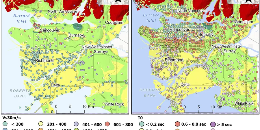
Methodology and scope
Local considerations
Two lots separated by less than 300 meters in Newmarket can sit on entirely different seismic site classes: the well-drained Halton Till uplands near Upper Canada Mall consistently register Vs30 values above 400 m/s (Site C), while low-lying parcels bordering the East Holland River often fall into Site D or E territory due to thick sequences of glaciolacustrine silt and soft organic clay. Constructing identical structural designs on both sites without microzonation data exposes the river-adjacent building to spectral accelerations 30–50% higher than what the default NBCC Site C assumption would predict. The practical consequence is a structure under-designed for the actual ground motion demand—increased drift, higher base shear, and potential non-ductile failure in older masonry elements. During the 2013–2018 Newmarket Official Plan review, several infill developments in the Davis Drive corridor triggered geotechnical peer reviews specifically because the preliminary soil investigation flagged a site class transition across the property. Our microzonation deliverables include a GIS-compatible shapefile that the structural engineer imports directly into their ETABS or SAP2000 model, assigning distinct response spectra to each foundation element based on its mapped location.
Applicable standards
NBCC 2020 (National Building Code of Canada), Division B, Section 4.1.8, ASTM D7400-19 (Standard Test Methods for Downhole Seismic Testing), CSA A23.3-19 (Design of Concrete Structures, seismic provisions), NCEER-97-0022 (SPT-based liquefaction triggering, Youd & Idriss 2001)
Associated technical services
Vs30 Site Class Mapping
Grid-based active and passive surface wave surveys producing a contoured Vs30 map with NBCC 2020 Site Class A through E polygon delineation. Includes fundamental period (T0) calculation and uncertainty bounds for each grid node.
Site-Specific Response Spectra
One-dimensional equivalent-linear ground response analysis using DEEPSOIL or SHAKE2000, with input motions scaled to the NBCC uniform hazard spectrum. Delivers design spectral ordinates at 0.2 s, 0.5 s, 1.0 s, and 2.0 s for direct structural model input.
Liquefaction Hazard Zonation
SPT-based and Vs-based liquefaction triggering evaluation per NCEER and Boulanger-Idriss (2014) procedures. Output includes factor-of-safety contour maps, post-liquefaction settlement estimates, and lateral spreading displacement screening for sloping ground near watercourses.
Typical parameters
Frequently asked questions
How does seismic microzonation differ from a standard geotechnical investigation?
A standard investigation classifies the entire site under one NBCC site class based on a single borehole or CPT. Microzonation maps the spatial distribution of Vs30 across the property on a grid, capturing lateral changes in soil stiffness. This matters in Newmarket because the glacial till can transition to soft silt over short distances, and a single-point classification can misrepresent the seismic demand for large-footprint buildings or multi-structure developments.
What does a microzonation study cost for a typical Newmarket development site?
Study costs range from CA$4,870 for a small lot with a basic active MASW grid to approximately CA$20,100 for a multi-acre parcel requiring passive array measurements, deep velocity profiling, and site-specific ground response analysis. The final figure depends on grid density, target depth, and whether liquefaction mapping is included.
Can microzonation results reduce the structural design loads for my building?
Yes, in many cases. When the mapped Vs30 values place portions of the site in a stiffer site class (e.g., Site C instead of the conservative default Site D), the NBCC short-period spectral acceleration Sa(0.2) can decrease by 20–40%. This reduction flows through to lower base shear, smaller footing dimensions, and measurable savings in concrete and reinforcing steel quantities.
How long does a seismic microzonation survey take in the field?
For a typical 1-hectare site in Newmarket, active-source MASW data collection with a two-person crew takes one field day. Adding passive SPAC recordings for deeper profiling extends the deployment to two days. Data processing, inversion, and map generation require an additional 7–10 business days before the draft report is delivered.