The Oak Ridges Moraine deposits that shape Newmarket's landscape create a challenging dichotomy for any contractor breaking ground here: dense, overconsolidated glacial till on the heights can stand steeply for short periods, while the silty-clay plains descending toward the Holland River remain saturated well into June, demanding a far more cautious approach to open cuts. Our geotechnical excavation monitoring bridges this uncertainty, deploying automated total stations, in-place inclinometers, and vibrating-wire piezometers that stream subsurface deformation data every fifteen minutes when the job demands it. We have supported excavations from the intensifying Davis Drive corridor right down to the redeveloping industrial lots near Bayview Parkway, where neighbouring structures built on shallow footings leave almost zero tolerance for lateral movement. Before a shoring design is finalized, many engineers pair the monitoring array with a targeted CPT test program to calibrate soil stiffness parameters against real pore-pressure dissipation data, which sharpens the predictive model and reduces overly conservative—and costly—wall sections.
In Newmarket's glacial terrain, distinguishing thermal beam breathing from soil creep saved one Yonge Street project three weeks of unnecessary re-shoring.
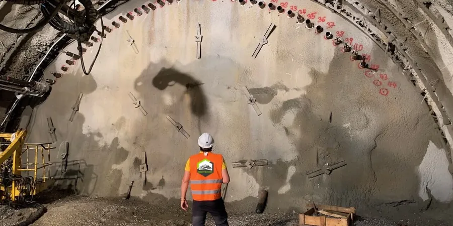
Methodology and scope
Local considerations
The risk profile differs sharply between the elevated moraine neighborhoods around Stonehaven and the low-lying industrial parcels south of Green Lane. Up on the till plains, the primary hazard is not collapse but progressive raveling of sand lenses exposed in the cut face—small, continuous sloughing that undercuts the shoring plates and gradually increases soldier-pile deflection until the H-piles yield. Down near the Holland River flood fringe, the danger is basal heave: the confined silty clay cannot drain quickly enough as the cut deepens, so pore pressures build behind the wall and the excavation floor starts to lift, sometimes taking the shoring with it. Monitoring directly addresses both scenarios by giving the superintendent a clear line in the data—when the inclinometer profile shows a distinct kink developing at the toe of the wall, the dig stops and the engineer re-evaluates the passive resistance before the morning pour. In addition, vibration monitoring with triaxial geophones has become standard practice on Newmarket sites that abut century-old masonry buildings on Main Street, where even a modest vibro-compaction rig can generate complaints and, more importantly, real structural distress if left unchecked.
Applicable standards
CSA A23.3-19 (concrete structures – deflection limits for adjacent buildings), ASTM D7299-20 (inclinometer probe verification), NBCC 2020 Part 4 (excavation safety and foundation requirements), ASTM D6230-21 (automated monitoring alarm protocols), OPSS 206 (Ontario Provincial Standard – geotechnical instrumentation)
Associated technical services
Deep Excavation Monitoring Package
Combines robotic total station tracking of shoring prisms, bi-axial inclinometer strings behind the wall, and vibrating-wire piezometers at multiple depths. Designed for cuts exceeding six metres or any excavation where the zone of influence extends under an occupied building. The system broadcasts deformation data to a cloud dashboard that the owner, contractor, and engineer can view simultaneously, eliminating the lag between measurement and decision.
Vibration & Settlement Monitoring
Targeted program for urban infill sites where the excavation itself is modest but the proximity to heritage masonry, sensitive medical equipment, or brittle utilities makes vibration control critical. Deploys triaxial geophones, settlement plates, and crack gauges with a dedicated on-site readout unit that triggers an audible alarm if the peak particle velocity exceeds the specification.
Typical parameters
Frequently asked questions
How much does geotechnical excavation monitoring cost for a typical Newmarket infill project?
For a standard residential or light commercial excavation in Newmarket—including initial instrument installation, bi-weekly manual readings over a two-month period, and a summary report—the cost normally falls between CA$1,060 and CA$3,170. The final figure depends on the number of monitoring points, whether automated real-time telemetry is required, and the site's accessibility for drilling the inclinometer casings.
How often are the instruments read during a deep excavation in Newmarket?
During active digging, the monitoring system is configured to record data every fifteen minutes and push it to the cloud dashboard. When the excavation is on standby—over weekends or during curing periods—the frequency drops to hourly readings. The fifteen-minute interval is driven by the speed of a typical hydraulic excavator; that cycle catches any unexpected deformation before the next bucket load is removed.
What triggers a stop-work order from the monitoring data?
The project-specific monitoring plan defines three alert levels. The first, typically set at 60% of the design allowable displacement, sends an SMS and email notification to the superintendent and engineer. The second, at 80%, requires a site meeting within two hours. If any instrument reaches 100% of the allowable value—whether that is 25 mm of lateral movement or 10 mm of settlement on an adjacent footing—the protocol requires a full stop of excavation until the cause is understood and the shoring design is re-evaluated.
Can the monitoring system be integrated with the shoring design during construction?
The reference range for this service in Newmarket Ontario is CA$1.060 - CA$3.170. The final price depends on the project scope and volume.